Shippingtelegraph: Tropical Storm Erin to pass north of US Virgin Islands and Puerto Rico
by Shipping Telegraph
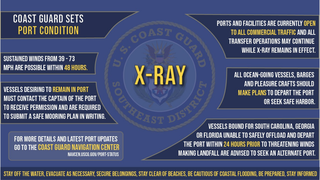
The U.S. Coast Guard has set its precautionary warning in place for all seaports in Puerto Rico and the U.S. Virgins Islands due to the Tropical Storm Erin.
The coast guard captain of the port-San Juan has directed the setting of port condition X-RAY at 4p.m. Thursday for the seaports, advising the maritime community to “remain vigilant” and take the necessary precautions as Tropical Storm Erin approaches the U.S. Virgin Islands and Puerto Rico on a west-northwest track across the Central Atlantic, officials announced.
“Locally heavy rainfall, high surf and rip currents, and tropical-storm force winds could occur in portions of the northern Leeward Islands, the Virgin Islands, and Puerto Rico this weekend as the core of Erin passes north of those islands,” according to the advisory on August 14 by the National Hurricane Center, which is closely monitoring the storm’s path and strength.
During port condition X-RAY, ports and maritime facilities are currently open to all commercial traffic and all transfer and cargo operations may continue.
As it is reported, vessels desiring to remain in port must have submitted their application for COTP approval prior to the setting of port condition X-RAY.
The Coast Guard highlighted that all ocean-going commercial vessels and ocean-going barges 500 gross tons and above that have not obtained captain of the port approval to remain in port should make plans for departing the port when port condition YANKEE comes into effect.
“Vessels bound for Puerto Rico or the U.S. Virgin Islands unable to depart 24 hours prior to threatening winds potentially making landfall are advised to seek an alternate destination,” the Coast Guard stated.
Furthermore, port facilities are advised to review their heavy weather plans and take all necessary precautions to adequately prepare for the expected conditions. Pleasure craft are also advised to seek safe harbor.
The National Hurricane Center’s Tropical Analysis and Forecast Branch (NHC TAFB) said Erin continues westward in the central Atlantic with max winds of 45 kt, gusts to 55 kt.
“Seas near the center are peaking ~16 ft (4.5 m). Swells generated by Erin will begin affecting portions of the N Leeward Islands, the Virgin Islands and Puerto Rico by this weekend,” NHC TAFB noted in a post on X yesterday.
Related Posts